


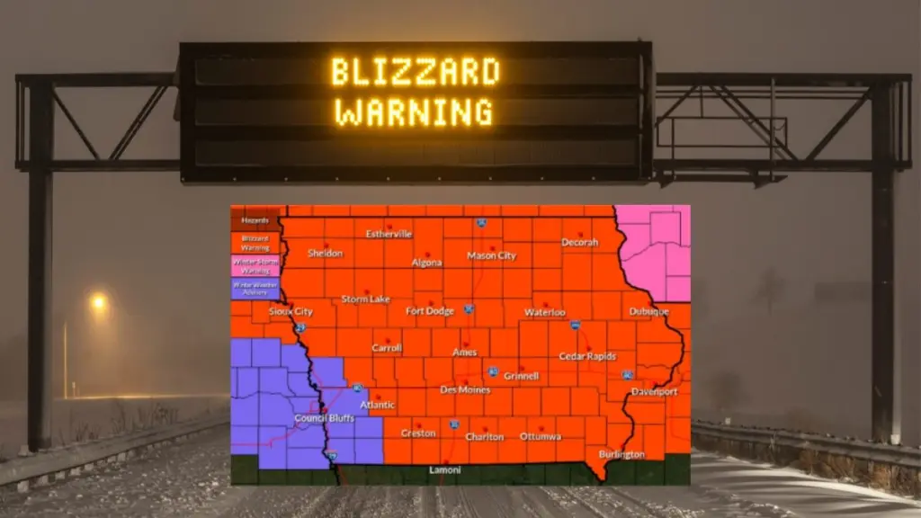
Response times from first responders may be significantly delayed as a powerful winter storm could bring strong winds, snow, and potential blizzard conditions to the listening area beginning later today (Sunday). The National Weather Service (NWS) has issued high wind and blizzard warnings for all of western Iowa. The possibility for severe weather is forecast to begin early Sunday afternoon, with north winds potentially gusting as high as 65 mph. Such winds could down trees and power lines, raising the possibility of scattered power outages. The blizzard warning is also in effect through 7 a.m. Monday across the listening area. Snowfall totals are relatively low, around 2 to 4 inches, but higher amounts are possible in some areas. Strong winds will likely cause significant blowing and drifting snow, reducing visibility and creating hazardous travel conditions. Carroll County Sheriff Ken Pingrey warns travelers who become stranded may have to wait hours before first-responders can reach them, and ambulances and fire trucks may have difficulties reaching calls for service if travel is too precarious. NWS staff recommend travel should be restricted to emergencies only. If you must travel, have a winter survival kit with you, including food, water, and warm clothing or blankets. If you get stranded, stay with your vehicle. Again, motorists are urged to avoid travel if possible and to check www.Iowa511.org for the latest road updates.