


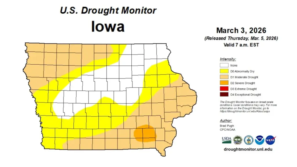
State officials have issued drought watches for northwest and southeast Iowa following a winter marked by limited snowfall and rainfall, according to the latest Water Summary Update from the Iowa Department of Natural Resources (DNR). The report shows drought conditions expanded across much of Iowa during February as precipitation remained well below normal. Preliminary data indicate the statewide average precipitation for February totaled just 0.38 inches, which is more than three-quarters of an inch below normal. Monthly totals ranged from no measurable precipitation at several monitoring stations in southern and northwestern Iowa to 1.26 inches in New Hampton. Southeastern Iowa recorded some of the driest conditions during the month. The National Weather Service reported the statewide average February temperature was 31.3 degrees, about 7.2 degrees above normal. The latest U.S. Drought Monitor map shows most of the state classified as abnormally dry or in drought, with portions of southeastern Iowa experiencing severe drought. Despite declining soil moisture levels, streamflows remain within normal ranges. The National Weather Service’s Climate Prediction Center forecasts above-average precipitation in March, which could improve conditions across much of the state. The drought watches were issued prior to heavy precipitation across much of the listening area late last week. The report is prepared by technical staff from Iowa DNR, the Iowa Department of Agriculture and Land Stewardship, IIHR—Hydroscience and Engineering, and the U.S. Geological Survey, in collaboration with Iowa Homeland Security and Emergency Management Department. A link to the complete February 2026 report is included with this story online.
____