
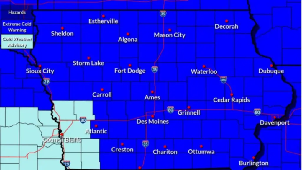
Nearly all of the Carroll Broadcasting listening area is under an extreme cold warning beginning tonight (Thursday) and continuing into the weekend. Available projections from the National Weather Service (NWS) show wind chills could drop as low as -40 °F starting overnight, and meteorologists say the next few days are likely to be the coldest conditions Iowans see this season. While not particularly dangerous for those who are prepared, people caught unaware could experience frostbite in just a few short minutes. NWS officials recommend that Iowans limit their time outdoors and cover exposed skin when they do venture out of the house. If travel is necessary, bring jumper cables, as vehicle starts may be unreliable, and keep an emergency kit handy that includes food, water, and cold-weather gear for passengers. Hour-by-hour forecasts show feels-like temperatures beginning to drop around 6 p.m. in Carroll, dipping as low as -34 °F by 6 p.m. Friday. Temperatures will start to warm throughout Friday and into the weekend, but they aren’t expected to top zero degrees until midday on Monday.