


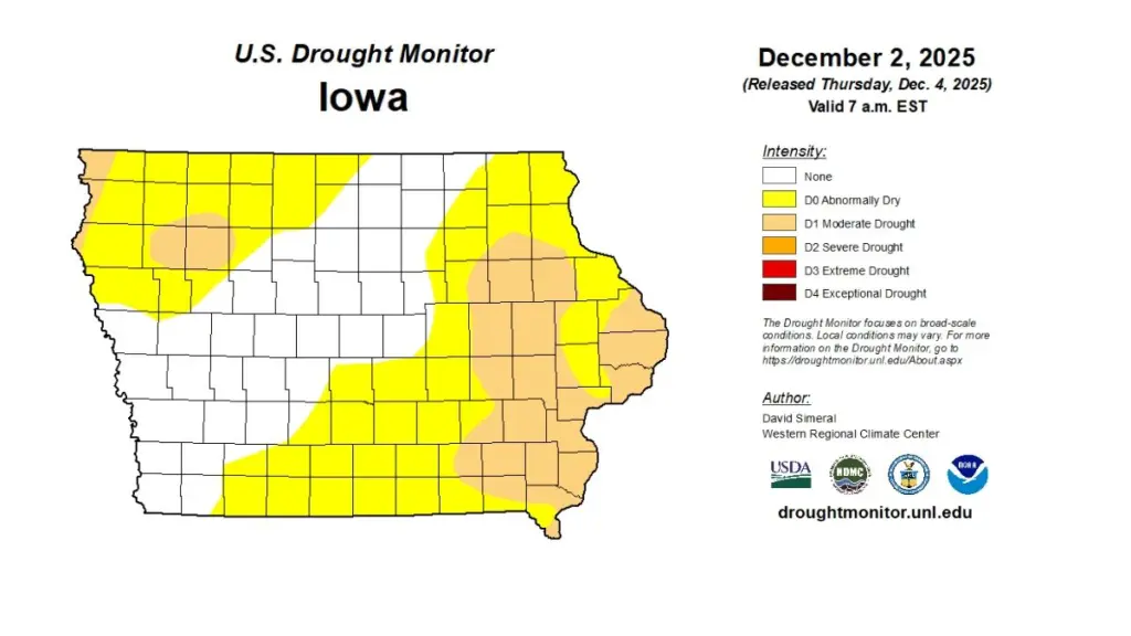
Persistent precipitation deficits through the fall have prompted a drought watch for parts of northwest and eastern Iowa, according to the Iowa Department of Natural Resources’ (DNR) latest Water Summary Update. Iowa saw continued below-average rainfall this autumn, contributing to the re-emergence and expansion of drought conditions across much of the state. November’s precipitation averaged 1.57 inches, about a quarter-inch below normal. However, the month ended with significant snowfall, averaging 8.6 inches statewide, nearly six inches above normal and marking the fifth-snowiest November in 138 years of records. The U.S. Drought Monitor now shows that two-thirds of Iowa is abnormally dry, with moderate drought affecting both the eastern and northwestern regions. Fortunately, nearly all of the listening area, excluding the northwestern half of Sac County, has sufficient moisture heading into the dryest months of the year. The National Weather Service’s (NWS) Climate Prediction Center outlook for December calls for a chance of below-normal precipitation in the southwest and colder-than-average temperatures statewide. Seasonal projections show drought conditions are likely to persist through winter except in southeast Iowa, where improvement is possible. The report is prepared monthly by technical staff from Iowa DNR, the Iowa Department of Agriculture and Land Stewardship, IIHR—Hydroscience and Engineering, and the U.S. Geological Survey, in collaboration with Iowa Homeland Security and Emergency Management Department. A link to the full November 2025 report is included with this story on our website.
______