

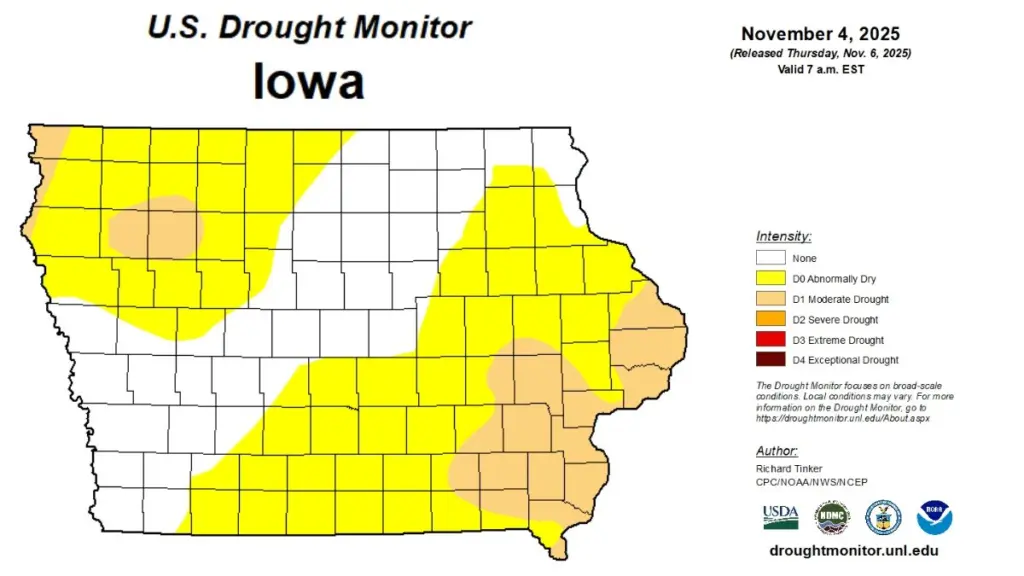
Warmer-than-average temperatures and below-normal rainfall in October have led to worsening drought conditions across Iowa, according to the latest Water Summary Update from the Iowa Department of Natural Resources (DNR). The state averaged 2.06 inches of precipitation in October, about 0.62 inches below normal, with some stations in northwest and southeast Iowa reporting deficits of one to two inches or more. The statewide average temperature of 57.2 degrees was 6.2 degrees above normal, ranking among the 15 warmest Octobers in more than 150 years of recordkeeping. The U.S. Drought Monitor now shows two-thirds of Iowa as abnormally dry, with moderate drought in the southeastern and northwestern regions. DNR Environmental Specialist Jessica Reese-McIntyre says, “After several months of rain deficits, drought returned and expanded across much of the state in October, coinciding with our entry into the typically drier time of the year. This persistent dryness has led to a drought watch designation for southeastern Iowa. Looking ahead, the latest seasonal outlooks indicate that there is potential for additional drought development in the southeastern region, with dry conditions likely persisting through January.” The monthly report is prepared by technical staff from Iowa DNR, the Iowa Department of Agriculture and Land Stewardship, IIHR Hydroscience and Engineering, and the U.S. Geological Survey, in collaboration with Iowa Homeland Security and Emergency Management Department. A link to the full October 2025 report is included with this story on our website.
______